December 2, 2008
We visited Chengde in July of this year. Chengde is about 3-4 hours northeast of Beijing by train in Hebei province, and makes a nice weekend outing. Chengde is located in a river valley with the Wulie River runing along the eastern edge of the imperial summer resort. Chengde's old name is Rehe (the Europeans called it Jehol) or Warm River after the hot springs and streams located inside the imperial resort.
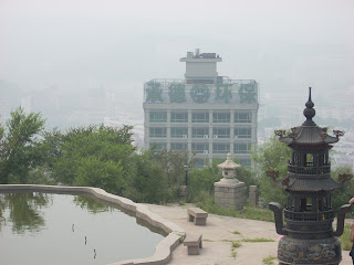
It was hot and hazy when we arrived in Chengde, and as these picture below show, Beijing doesn't have a monopoly on pollution. In his book, Mapping Chengde: The Qing Landscape Enterprise (University of Hawaii Press), Philippe Foret says on p.99 that Chengde has seen an expansion of cement and ceramic factories as well as the building of a titanium processing plant and it shows. The first picture shows a bend in the Wulie river, along with all the residential housing going up in the city. I like the third picture because it shows the office building housing the Chengde Environmental Protection Agency (you can barely make out the Chinese characters) with a thick layer of smog covering the city behind it. Obviously, the Environmental Protection people have some work to do in cleaning up the air in this historic city!
Here's a picture of the entrance to the hotel we stayed in, the New Century Rehe Hotel. It's actually located inside a shopping mall and to get to our rooms, you had to go through this door and climb up a flight of dark stairs to the 3rd and 4th floors where the rooms were. Not highly recommended, but it was cheap, about U.S.$30 a night.
THE MOUNTAIN VILLA
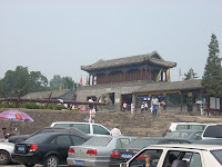
After leaving our "hotel", we made a beeline for the central attraction: the imperial summer resort built by Emperors Kangxi and Qianlong, also known as Bishu Shanzhuang, which translates roughly into "Fleeing the Heat Mountain Villa". I assume the emperors were fleeing the heat of Beijing, and indeed it did feel cooler inside the villa due to all the trees. We entered the front gate, known as Lizheng Gate, shown here along with an introduction the villa.
Below is a map of the villa. The Lizheng Gate is down at the bottom. On the right hand part of the map (north and east), you can see the 8 Outer Temples (waiba miao) that we visit later. Note also the Wulie river running alongside the eastern edge of the villa, and the lake district on the lower right. To the north of the lake district is the prarie district, while to the west is the hill district. As Foret details in his book, each of these districts evokes different parts of the Qing empire: the lake district evokes the area of China known as Jiangnan, the prarie district is a reminder of the Mongolian plains, and the hill district evokes the northern frontier from which the Manchus originated.
The pathway through the Lizheng Gate leads to a series of 9 courtyards with 5 halls. The first hall is the Hall of Simplicity and Sincerity which was built in 1711 out of aromatic cedar as a place for the emperor to rest. One can imagine the Emperor Kangxi catching a quick snooze in that yellow throne while being serenaded by these musicians.
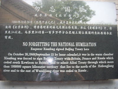
The Chinese never miss an opportunity to remind us of their national humiliation. Walking through the courtyards, I came across this sign. The signing of the Beijing Treaty was followed later that year by the burning down of the Summer Palace in Beijing by British forces. As we'll see, parts of this resort were also damaged by invading Japanese forces during World War II.
Emerging from the courtyards, you come out onto the Lake District which is supposed to evoke the landscape of the Jiangnan region in eastern China.
A footnote about the lake district. According to Foret (pp.51-52), there is a hill built here called Jinshan Hill (Golden Hill) that forms an important axis with Qingchui peak, otherwise known as Club Rock (see pictures below). Qingchui peak is supposed to have cosmological significance because of its parallel with the sacred Sumeru mountain in Buddhist cosmology. The problem with Qingchui peak is that it lies to the east of the 8 outer temples and thus lacks a central location in Chengde. Foret argues that this problem was solved by building Jinshan Hill (complete with temple) in the middle of the summer resort so that it runs in a straight line from Qingchui peak through the middle of Pule temple (one of the 8 outer temples). Jinshan thus substitutes for Qingchui peak in a central location and serves as a metaphor for Sumeru. Make sense?
Here are some naughty children feeding some sika deer which roam wild in the resort. There are signs telling people not to feed the deer or get close to them, but this being China, people usually tend to ignore the signs and do what they want.
One thing I didn't realize was how much this resort was used as a kind of public space. There are all kinds of people congregating here just hanging out, singing, doing their own thing. Here's a group of people singing and playing instruments while others sit and watch.
Walking north from the lake district, you come across the prairie district. We saw these yurts with a people standing around, so we took a peek out of curiousity. It turned out to be a touristy talent show with a "Mongolian cowboy" belting out some Mongolian folk songs. That was followed by a group of little girls dancing around in Mongolian costumes. Do I hear Genghis Khan turning over in his grave?
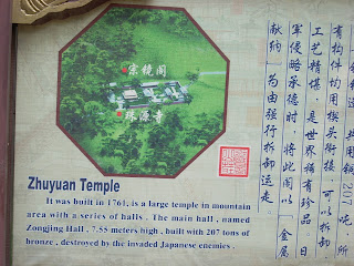
Walking west away from the Mongolian cowboy, we entered the hill district. This is a very large area, and we didn't have time to see much of it, but we did take in the Zhuyuan temple (or what was left of it) which was destroyed by Japanese troops during World War II. You don't usually get to see ruins in China because the Chinese are so efficient at reconstructing historical sites, so to see some actual ruins was a treat.
THE OUTER TEMPLES (waiba miao)
The following day, after a good night's sleep in our luxurious accomodations (did I mention we didn't have water for a few hours?), we took a bus to some of the outer temples that encircle the imperial resort.
Our first stop was Puning Temple, which I have to say is one of my favorite temples in China, and the only active temple among the 8 outer temples. According to Foret, Puning houses the local Buddhist association (the Communist Party supervises the Buddhist temples through these associations). (On a historical note, Foret on p.51 says that during the Qing dynasty, many of the 8 outer temples did not have a permanent religious community and were under supervision of the Imperial Household Court, while the clergy of some of the other temples were largely Mongols.) Surprisingly, no one else in our bus wanted to wander in, so we had to rush through the temple grounds while the rest of the group waited for us on the bus.
Puning Temple, also known as the Great Buddha Temple or the Temple of Universal Peace, is a blend of Chinese and Tibetan temple architecture. It was built in 1755 to commemorate Qianlong's pacification of the Zungar tribes in Xinjiang. While Puning is said to be modelled on the earliest Tibetan Buddhist monastery (Samye), it looks in many respects like many other Buddhist temples we've seen in China, although the rear portion of the temple grounds and the facade of some of the outer walls have some Tibetan influences. As Foret notes, the fusion of Chinese and Tibetan features was as much for Tibetan visitors to the Qing summer court as it was for Mongols who were themselves followers of Tibetan Buddhism. In this sense, as Foret notes on p.53, temple construction in Chengde served the Qing's policy of incorporating Tibetans and Mongols into its empire. One sees the incorporation of Chinese, Tibetan and Mongol themes in many of the Chengde temples.
When you first enter the temple, you are met by chubby Milefo, the Laughing Buddha (see picture on left), which apparently is typical of Lama Buddhist temples. Behind that is the Hall of Heavenly Kings housing three images of Buddha. But what takes your breath away is the next hall, the very tall and elaborate Mahayana Hall (see picture on the right) which houses one of the most beautiful Buddhist statues of Guanyin Buddha (the Goddess of Mercy) anywhere. The golden statue is 22 meters tall and made out of 5 different kinds of wood: pine, cypress, fir, elm, and linden. The statue shows Guanyin with 42 arms, with each palm bearing an eye and each hand holding an instrument, skulls, lotuses, and other Buddhist devices. Unfortunately I was not allowed to take a picture of the statue. You'll just have to take my word that it was a sight to behold.
Going further toward the rear of the temple, I discovered a band of musicians and architecture with more of a Tibetan influence. Note the white block-like shapes, the stupas, Tibetan prayer wheels....
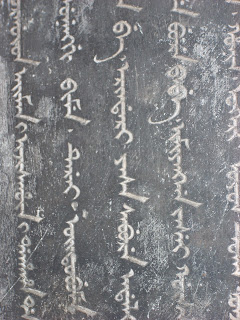
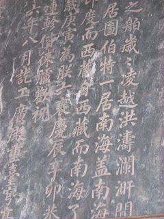
After Puning, we quickly jumped on the bus which took us to the temple that was on everyone's itinerary: the Putuozongcheng Temple, which is a miniature version of the Potola Palace in Lhasa. Foret (p.51) notes that this temple is the most important temple in Chengde in terms of size: it is ten times the average size of a Chengde temple. The temple was constructed in 1767-1771. It really is a beautiful temple although the views of the temple would have been nicer on a clear day. Here are some pictures of the entrance to the temple, followed by a large stele pavilion which has Chinese, Mongol, Tibetan and Manchu writing on it (see if you can guess which is which!), a triple archway topped with 5 stupas, the skull of a yak(?), and stone elephant whose knees are bent at a fantastical angle.
The most striking structure is the Red Palace which contains most of the main shrines and halls in the temple complex. Running down the front of the Red Palace are collections of prayer flags.
Here is a view looking westward from the Red Palace toward the hills encircling the imperial summer resort that we had visited the day before. One imagines that during the 1700s, the air was a bit clearer than what we experienced on this hazy July day in 2008.
Monday, December 1, 2008
Wednesday, October 22, 2008
Travelling the Silk Road: A Virtual Tour
October 22, 2008
This blog traces our journey along the eastern part of the Silk Road starting from its eastern terminus in the city of Xi'an (also known as Chang'an when it was the capital of the Tang dynasty and one of the world's great cosmopolitan centers) and moving westward to Urumqi, the present-day capital of China's westernmost province of Xinjiang. From Urumqi, we took a bus to the Turfan basin which is the lowest and the hottest spot in China, and then a car to Heavenly Lake in the Tianchi mountains. Unfortunately, we did not make it to two important Silk Road stopovers -- Dunhuang in Gansu province and Kashgar which is on the edge of China's western border. Dunhuang's caves contained a treasure trove of documents and art that tell us much of what we know about life along the Silk Road between the 8th and 10th centuries. Kashgar was an important crossroads for East-West interaction, and is famous for its lively bazaar (marketplace).
XI'AN
Xi'an sits in the Wei river valley which has been home to the capitals of several major dynasties, including the Qin, the Western Han, and the Tang. Xi'an (or more precisely the nearby town of Xianyang) is home to the terracotta warriors (see picture below) and the tomb of the emperor who first unified China and established the Qin dynasty. The city reached its peak in the Tang dynasty when it was a bustling cosmopolitan center for East-West trade along the Silk Road, and a place where many different cultures and religions coexisted.
One sign of this religious diversity can be found in the famous Muslim quarter which we visited and ate lunch. The Muslim quarter is home to much of the city's Hui (Chinese Muslim) community. Muslims have been here since at least the 7th century, though today's community is said to date back to the Ming dynasty.
The Muslim quarter is home to the Great Mosque which was said to have been founded in the 8th century, although most of the buildings date back to the more recent Ming and Qing dynasties. The Great Mosque contains an interesting mix of Chinese and Islamic architecture. It faces west towards Mecca but contains many features one finds in Chinese Buddhist temples and gardens such as rocks, pagodas and archways (see pictures below). (Speaking of Buddhist temples, Xi'an is also home to the Big Goose Pagoda which is surrounded by Da Ci'en Temple, one of the largest temples in Tang dynasty Chang'an. The pagoda housed Buddhist sutras brought back from India by the monk Xuan Zang who spent much of his life translating these scriptures.)
In the Muslim quarter, we ducked into a restaurant for a taste of yangrou paomo (made of flat bread crumbled into a bowl of noodles, mutton and broth), lamb kebabs, noodles and tea. A meal that was very different from what you'd find in a typical Chinese restaurant.
There were also many vendors selling dried fruit, nuts, and the delicious peanut and walnut cakes and dried permissons (see picture on the left). We picked some peanut cakes up from this friendly gentleman.
URUMQI
After Xi'an we flew to the Xinjiang capital of Urumqi. Xinjiang is fascinating: it's very different from the rest of China both geographically and demographically. It's population is very diverse and contains around 50 ethnic groups, many of whom have more similarities with Central Asian peoples than with Han Chinese. The main ethnic group are the Uighurs, but there are also Kazahks, Hui, Mongols, Russians, etc. There are also quite a few Han Chinese settlers. Xinjiang these days is under a tight security blanket because of acts of violence committed against Chinese police and militia in the last few months. There is a small separatist movement here which has been fighting for the creation of a East Turkestan state. They have been branded terrorists by the Chinese government, but other Uighers who are not part of this group have been implicated and harrassed as well. When we traveled to Xinjiang last summer (2007), the violence had not yet flared up and the security thankfully was not so tight.
Urumqi seems like a regular Chinese city with little of the Muslim flavor present in places like Turfan and Kashgar. There is a major bazaar, Erdaoqiao which also boasts a KFC (note the Arabic script underneath Colonel Sanders, and the Chinese characters for KFC just above the doorway)......
.....and of course the Uighur food which we took in at a well-known local restaurant (what you see in this picture is lamb kebabs, polo or rice pilaf, nokot or chickpeas with carrot, yogurt and tea)...
....and stands along the street selling flat bread (nan) and lamb kebabs, but otherwise not much else to suggest that we are moving away from China and towards Central Asia.
From Urumqi, we took a cheap, but comfortable airconditioned (very important!) bus into the hot Turfan basin, about a 2 1/2 hour ride east of Urumqi. As we drove into the basin, we could feel the temperature rising in the bus. In the remaining pictures, you'll see the extremes in the geography of this region, from grassland to desert to high mountains, and get some sense of how inhospitable and difficult the terrain was for travelers coming along the Silk Road who had to navigate this terrain.
TURFAN (TURPAN)
We went to Turfan in August, so it was hot but our driver who we had hired when we got into the Turfan bus station told us it was pretty pleasant for Turfan, only in the mid-90s. (Apparently, temperatures around 110 during the summer are quite common.) Our driver took us first to Grape Valley, a lush green valley where grapes are grown. Grapes and raisins are one of Xinjiang's main crops and grape vines, and grapes being laid out to dry everywhere. On the left is a picture of where we stopped to have lunch (notice the large clusters of grapes hanging on the trellis). Grape Valley is the green area just behind the girl in the traditional Uighur dress.
Our next stop was to look at a karez, which is an ingenious kind of irrigation system used to irrigate crops in this hot, arid landscape. The term "karez" refers to a system of underground channels dug to bring water from the mountains down to the plains. The picture below on the left shows an actual channel. At regular intervals along these channels are dug wells to allow people access to extend the channels further (see picture of the scale model on right). This entire system is fed by gravity thus eliminating the need for pumps. Having the channels underground also reduces water loss from evaporation. Turfan, and a number of other oasis towns in the area, owe their existence to the karez, some of which were constructed more than 2000 years ago.
From the karez, we moved on to the Jiaohe ruins. These ruins, along with the Gaochang (Khocho) ruins are a reminder of the importance of this region to the Chinese empire during the Han and Tang dynasties. Jiaohe was a military garrison during the Han and Tang dynasties, while Gaochang was the Uighur capital in the 9th century and an important provincial post on the Silk Road until it burned down in the 14th century. Jiaohe is striking not only because the ruins are still well preserved, but because its baked ruins are built on this leaf-shaped plateau bounded by two verdant river valleys. Here's one of the river valleys. The Jiaohe ruins sit on the plateau to your right.
Among the ruins in Jiaohe are a Buddhist temple built around the 5th century (picture on the right), and a stupa (picture on the left), reminders of the early Buddhist influence in this region that came via the Silk Road through India. I also couldn't resist putting in a picture of what looked like Homer Simpson's profile (did he come on the Silk Road?), and a picture of the site of what is thought to be the Jiaohe government office.
As my wife remarked to me later, one amazing thing about these ruins is that many of the structures remind you of the present dwellings you see all around Turfan. I've included here a picture of a present-day cemetery in the village of Tuyoq on your left, and a picture of the ruins on your right. A reminder of how little things have changed out here in the hinterland.
We then asked the driver to take us to the village of Tuyoq which is off the beaten tourist track. On the way, we stopped to snap a picture of Flaming Mountain and got back quickly into the (barely) airconditioned car.
The village of Tuyoq was an fascinating place that looked like it had been preserved for centuries. It mainly produces grapes (what else!) and has been a pilgrimage site for Muslims for centuries. Below are some pictures of the village. The picture on the left is facing the village mosque. Note the beds on the roof in the foreground. When we asked about this, we were told that people often sleep on the roof in the evenings because it's cooler. The picture on the right is taken on a hill behind the mosque.
As noted, Tuyoq has been a destination for Muslim pilgrims who go to the village to visit the mazar, or symbolic tomb of the first Uighur Muslim. The mazar is up on a hillside above the village surrounded by earthen walls. When we ventured up, there were a number of people inside the mazar (the structure with the green roof). They did not allow us to go inside. Up on the hillside, there were poles with pieces of clothing tied to them which function as prayer flags.
Further upstream from Tuyoq are a series of Buddhist caves dating back to the 3rd century B.C. Some of the art was damaged, we were told, by Muslims and Japanese soldiers. I tried to take some pictures of the cave art, but a guard was standing there telling me no pictures. When I tried to take one, he tried to take my camera away. I told him no way, and then agreed to delete the picture.
HEAVENLY MOUNTAIN (TIANCHI)
After several days in Turfan, we hired a car to take us up to Tianchi (Heavenly Mountain) which is part of the Tianshan mountain range that runs east-west across central Xinjiang. Tianchi is a picturesque glacier lake about 7,000 feet in elevation, though some of the peaks around the lake reach over 16,000 feet. We stayed in a Kazakh yurt by the lake and hired some Kazakh guides to take us up the mountain by horseback. This area is settled mainly by Kazakhs who raise sheep on the mountainside. Below you see the two guys who led our horses up the mountain. Note their facial features which are more akin to people of Central Asia than to Han Chinese. Also below are pictures of the outside and inside of the yurt where we slept. The wood stove inside the yurt came in very handy as temperatures even in August went down to the 50s.
We asked the people who managed the yurts to kill a sheep for us and roast some lamb kebabs for us. They were the best kebabs I've ever had. We shared them with some other backpackers who were staying there -- an Israeli, a Dutch couple, and two Afghan New Yorkers who were working in Kabul for the U.S. government -- along with a simple meal of rice pilaf, carrots and tea.
Subscribe to:
Posts (Atom)